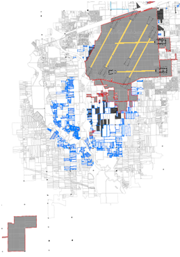
Detroit Metropolitan Wayne County Airport (DTW), as part of the development of a new Master Plan, undertook the task of development, collection and conversion of GIS data with the goal of creating and submitting a completed data set for the DTW Airport. Portions of this data will also support the development of the standard Airport Layout Plan and potentially some of the analysis the Master Plan will perform.
Survey Work Performed:
- Airport Exhibit A - Conducted a complete boundary survey of the entire main airport property.
- Conducted a complete boundary for wetlands mitigation area.
- Field Collection inventory of NAVAID’s (part of the runway)
- Verification of PACS/SACS Primary and Secondary Control.
- Verification of FAA runway obstructions ground survey
- Collect ground transportation and data collection at 7 curbside locations: North & McNamara Terminals.
- Ground transportation data collection included: vehicle dwell times and commercial vehicle classification.
- Collected utilities capabilities assessment information compiled from prior utility studies