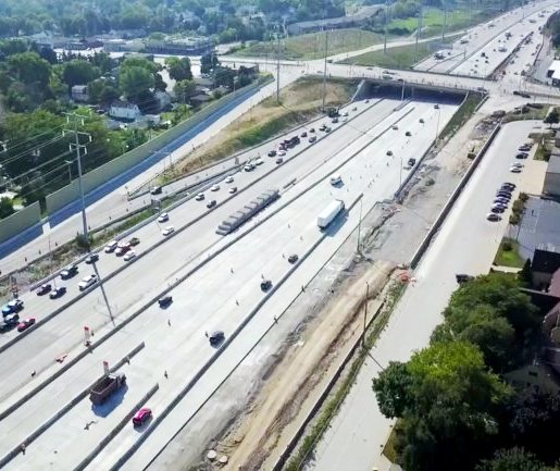
Project Location:
The project is located along I-94 (I-96 Conner Avenue), Wayne County, Michigan.
General Project Description:
Improve the capacity and condition of the existing I-94 roadway and interchanges to support the mobility needs of local and interstate commerce as well as national and civil defense. The condition of the existing facility is the primary need for action. The condition and capacity problems have resulted in this section of I-94 being recognized in statewide and regional plans as the Michigan roadway section most needing action. Project highlights are as follows:
• 6.7-mile roadway reconstruction/widening from 1-96 to Conner Ave.
• Adds 1-94 main travel lane in each direction
• Replace aging bridges (vehicular, pedestrian, RR)
• New continuous 1-94 service drives (impacts> 300 parcels)
• Improve drainage system
• Upgrade geometries including 1-94/M-10 and 1-94/1-75 Interchanges
Description of Pick-up Survey Performed:
Phase I
A. Search and recover 6 MDOT primary control monuments established in 2008 for JN32587.
B. Obtain GPS-RTK observations for recovered primary control monuments [(2)-3 min. occupations/mon].
C. Prepare a comparison report, NAD83(CORS96) vs NAD83(2011), rendering a compilation of results.
D. Meeting/Interface with MDOT Survey Unit regarding the results.
Phase II
A. Obtain static GPS observations simultaneously for the 6 primary control monuments.
B. Compute coordinates using only non-trial vectors between the 6 receivers & CORS stations.
C. Obtain NGS OPUS data to verify adjusted coordinated values.
D. Prepare control summary report.
E. Establish & document a preliminary procedure for translating existing Microstation files for the project.
F. Submit summary report & documented translation procedures to MDOT Survey Unit for review/approval
Phase III
A. Recover existing control irons and bench marks from the I-94 reconstruction project [JN32587 (2007)].
B. Set additional control and bench marks for each of the bridge structures.
C. Provide level observations on scan target set for project by SSI.
D. Perform intermediate control observations via conventional methodology.
E. Establish legal alignment(s) and stationing including all 8 Advanced Bridges, on/off ramps & service roads.
F. Locat 26 private claim & government corners.
G. Establish the right-of-way limits, delineated parcels & identified ownership.